Protect Our Coast
The Coast situated in the Shires of Coorow, Dandaragan and Gingin has long served as a setting for a diverse range of recreation activities.
This section of isolated, rugged and dynamic coastline is situated on the northern fringe of Perth and extends to just North of Leeman. Its proximity to the city and surrounding rural and coastal communities ensures consistent use throughout the year. Visitors can undertake a wide variety of nature-based recreation activities either independently or with commercial tours.
The remoteness, challenging terrain, sense of isolation and beauty of the coast has become the domain of four-wheel drive owners. It is these users, whose numbers are rapidly increasing, who are contributing to the alteration of this fragile landscape and diminishing conservation as well as cultural values.
In 2022 the Shires of Coorow, Dandaragan and Gingin were awarded a Community Stewardship grant from the Department of Primary Industries and Regional Development (State Natural Resources Management Program) to develop a Masterplan to manage coastal impacts of vehicles north of Perth.
The primary aim of the project is to develop a masterplan for the management of vehicles in coastal reserves and associated educational material. The educational material comprises of 30 road signs and 50,000 educational brochures.
Coastal Recreation Track Management Master Plan
The Coastal Recreation Track Management Master Plan (CRTMMP) presents a strategy to allow recreation activities to continue in the project area while protecting its landscape and conservation values.
It investigates all relevant issues pertaining to the provision of a safe and enjoyable recreational setting that is both easily manageable and retains the conservation and cultural value of the reserves.
The CRTMMP considers issues identified in other plans created to identify and manage coastal planning issues on the Central Coast in Western Australia. These include coast management plans, CHRMAP, inundation studies, economic strategies, regional strategies, and other relevant coastal plans. It also considers information on coastal and track management from interstate, national and international sources.
The CRTMMP also considers DBCA plans relevant to coastal management from the Southern boundary of the Shire of Gingin through to the Northern Boundary of the Shire of Coorow. One of these plans is the Nilgen Wanagarren Master Plan 2007. In considering the issues and recommendations in these plans, it will result in a consistent land management approach for the coast north of Perth to Leeman.
The Shires of Coorow, Dandaragan and Gingin received funding from the State Natural Resource Management Program along with co-contributions from the Shires and in-kind contributions from land managers, community groups and volunteers to complete the CRTMMP.
The Master Plan has been prepared in three separate documents covering:
1 - Coastal Recreation Track Management Master Plan
The Master Plan document:
Coastal Recreation Track Management Master Plan Rev D.1 June
2 - Coastal Recreation Track Management Master Plan, Site Assessment Tables
The Site Assessment document, covering site assessment details and site pictures separated into local government areas.
CRTMP_Site_Assessment_Tables_Rev_B_March_2025
3 - Coastal Recreation Track Management Master Plan, Map Set
The Map Set Document, map set with main coastal tracks marked out and separated into local government areas.
ORVP MP Map Set Rev_C_April_2025
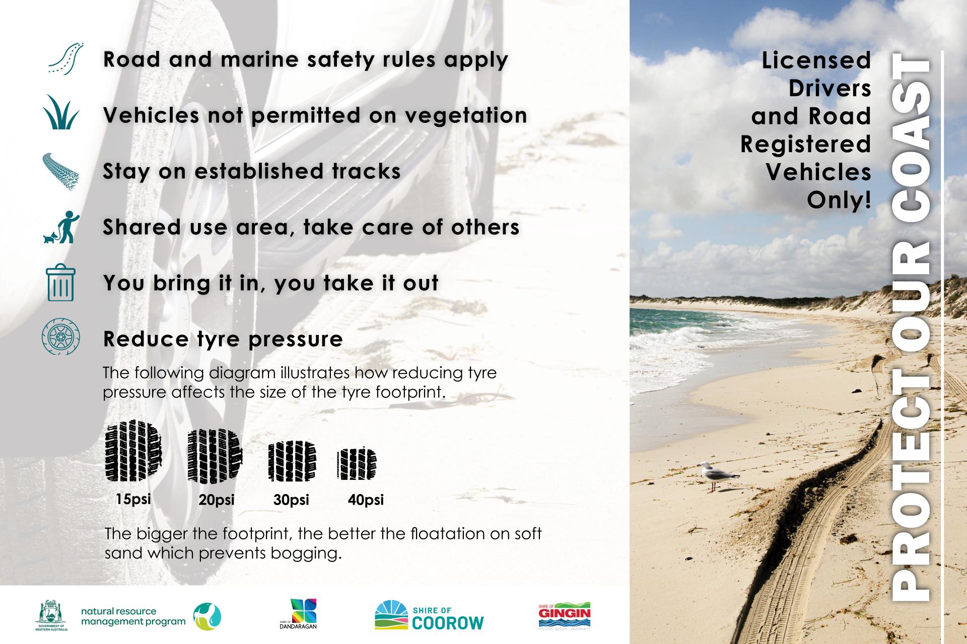
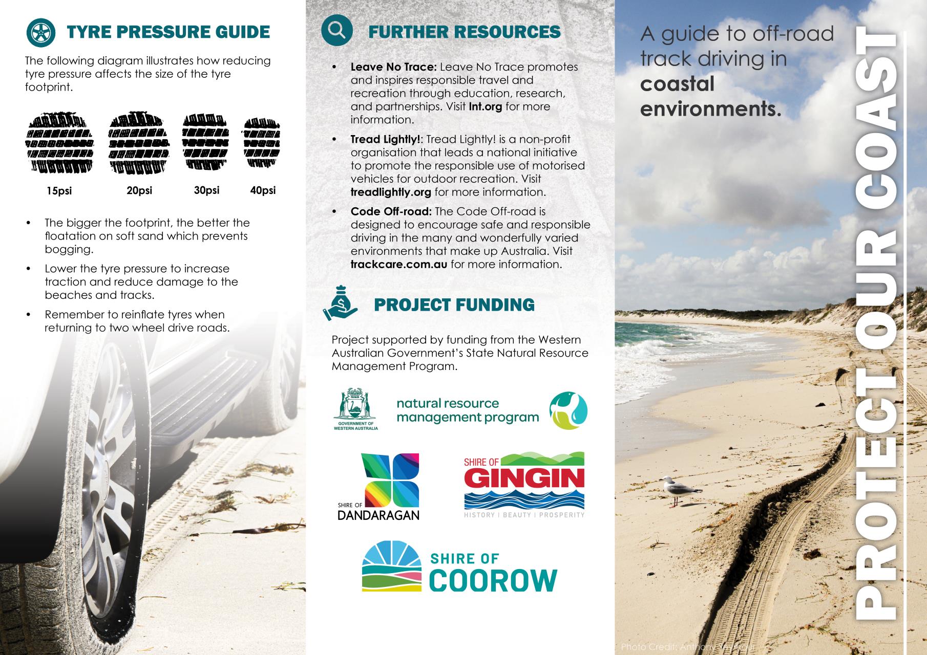
Protect Our Coast Educational Brochures
Local governments prefer to educate the public on the use of public resources and lands rather than use infringements and penalties to enforce compliance. The key education messages for using coastal environments and tracks have been established by four-wheel drive users, community groups, local government and government over time.
The Protect Our Coast Educational Brochures were approved for distribution and printed in April 2025, these brochures can be found at many different locations throughout each Shire, including Shire administrations centres, visitor centres, caravan parks, libraries, service stations, cafes/restaurants, etc.
To view the Protect Our Coast Educational Brochure digitally, click here. A preview is also displayed below:
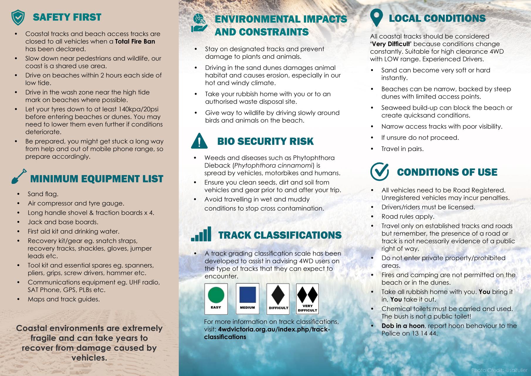
Protect Our Coast Road Signs
The Protect Our Coast Road Signs supplement the Protect Our Coast Educational Brochures. These road signs can be found at locations throughout each Shire where entrances/exits to coastal tracks have been identified. The signs contain a clear overview of the key messages displayed in the Protect Our Coast Educational Brochures.
To view a digital version of the Protect Our Coast Road Signs, click here. A preview is also displayed below: